- What is the most reliable source for a Texas map of flooding?
The most reliable source for current Texas flood maps is the official FEMA Flood Map Service Center and the Texas Water Development Board (TWDB) which provides comprehensive state-level data and flood risk assessments.
- How do I interpret a Texas flood map image for my property?
On a Texas flood map, locate your property and identify the colored zones. These colors correspond to different flood risk categories, such as Special Flood Hazard Areas (SFHAs) which indicate a 1% annual chance of flooding. Always consult the map legend.
- Are there real-time HD images for Texas flooding available?
While direct HD images of active flooding are not always universally available, many local emergency management agencies and news outlets often provide near real-time aerial footage or photos. The National Weather Service also offers interactive Maps showing current river levels and flood warnings.
- Where can I find a Texas map of flooding specific to Houston or Dallas?
For city-specific Texas flood maps like Houston or Dallas, visit the respective city or county emergency management websites (e.g., Harris County Flood Control District, Dallas County Emergency Management). They often provide hyper-local, high-resolution data integrated with Local MAP features.
- What do the different flood zones mean on a Texas flood map?
Flood zones on a Texas map signify varying levels of flood risk. Zone A and V are high-risk areas requiring flood insurance. Zone X (shaded) indicates moderate risk, and Zone X (unshaded) means minimal risk. Understanding these zones is crucial for insurance and safety.
- How often are Texas flood maps updated by FEMA or the state?
Texas flood maps, particularly FEMA's Flood Insurance Rate Maps (FIRMs), are periodically updated, but not on a fixed schedule. Updates occur as new flood studies are completed, typically every 5-10 years, or when significant land changes or new data become available. Always check the effective date.
- Can I use my mobile Maps app to see current Texas flood road closures?
Yes, many mobile Maps apps like Google Maps and Waze integrate real-time traffic and incident data, including road closures due to flooding in Texas. Local authorities often feed this information directly. Always verify with official emergency alert systems for critical travel decisions.
Staying informed about Texas flood maps is crucial for residents and visitors alike. This guide offers up-to-date information on how to access and interpret real-time flooding data across the Lone Star State. From coastal regions susceptible to hurricane impacts to inland areas prone to riverine and flash floods understanding your flood risk is paramount for safety and property protection. We explore the best digital resources including official government platforms and local municipality tools providing clear actionable insights. Learn where to find detailed inundation maps, understand flood zone classifications, and utilize interactive mapping features to monitor current conditions and forecast potential hazards. This essential resource empowers you with the knowledge to navigate Texas flood information effectively and helps you locate where critical information is available.
- Where can I find the most accurate real-time Texas flood maps? - For the most accurate real-time Texas flood maps, consult the Texas Water Development Board (TWDB) and FEMA's Flood Map Service Center. These platforms offer official, detailed data on flood risks and current conditions across the state, crucial for immediate situational awareness.
- How do I check flood zones for my property on a Texas map of flooding? - To check flood zones for your property, use FEMA's Flood Map Service Center. Enter your address, and the Local MAP will display your property's flood zone classification, indicating your specific risk level and potential flood insurance requirements in Texas.
- Are there interactive Maps showing current road closures due to Texas flooding? - Yes, many mobile Maps applications like Google Maps and Waze integrate real-time data from local authorities regarding road closures caused by Texas flooding. Always cross-reference with official emergency management websites or the Texas Department of Transportation for critical updates.
- What do the colors on a Texas flood map signify regarding risk? - The colors on a Texas flood map indicate different flood risk levels. Typically, darker shades or specific letters (like 'A' or 'V') denote high-risk areas (Special Flood Hazard Areas), while lighter shades or 'X' signify moderate to low-risk zones. Always refer to the map legend.
- How often are the official Texas flood Maps updated? - Official Texas flood Maps, particularly FEMA's Flood Insurance Rate Maps (FIRMs), are updated periodically as new flood studies are completed or significant changes occur. While there isn't a fixed schedule, updates can take several years, so always note the map's effective date for the latest information.
- Can I use Local MAPs on my phone to track Texas river flooding? - Yes, you can use Local MAPs on your phone to track Texas river flooding. The National Weather Service (NWS) often integrates real-time river gauge data into interactive maps. Several apps also pull this information, providing current and forecast river levels, crucial for areas near major waterways.
- Where can I find historical Texas map of flooding data for my area? - Historical Texas map of flooding data can often be found on the Texas Water Development Board's website or through local historical societies and government archives. FEMA's Flood Map Service Center may also provide access to previous flood insurance rate maps for comparison and research.
Navigating the complexities of flooding in Texas can be daunting. With weather patterns shifting, having immediate access to reliable flood maps is essential for everyone from homeowners to emergency responders. This guide cuts straight to the chase, providing you with the vital information you need to understand and utilize Texas flood maps effectively in 2026. Get ready to pinpoint critical data and stay informed about your local area.
Frequently Asked Questions
Where can I find the most current Texas flood maps?
The absolute best locations to find current Texas flood maps are through the Texas Water Development Board (TWDB) and FEMA's Flood Map Service Center. These platforms offer detailed, official data for all Texas communities.
How do I use Local MAPs to check Texas flooding?
Pull up your preferred mobile Maps app to verify real-time road closures or flooded areas. Many local emergency management agencies integrate with Google Maps or Waze to display current conditions. Always cross-reference with official alerts.
What are the best times to check flood updates or get parking info during a flood event?
During a flood event, check updates frequently, every few hours, as conditions change rapidly. For parking, aim for higher ground areas designated by local authorities.
- Elevated garages in city centers
- Designated public high-ground lots
- Avoid street parking in flood-prone zones
Key Texas Flood Information Resources:
- Resource Name: Texas Water Development Board (TWDB)
- Focus: State-level flood planning, mapping data
- Resource Name: FEMA Flood Map Service Center
- Focus: Official flood insurance rate maps (FIRMs), flood hazard zones
- Resource Name: National Weather Service (NWS) - Texas
- Focus: Real-time weather alerts, river gauges, flood forecasts
- Resource Name: Local County Emergency Management Websites (e.g., Harris County, Dallas County)
- Focus: Hyper-local flood alerts, road closures, emergency shelters
Access official Texas flood maps easily. Understand current and forecast flood conditions. Identify flood zones for property risk assessment. Utilize interactive digital mapping tools. Stay safe with timely flood information. Locate key emergency resources for specific areas.


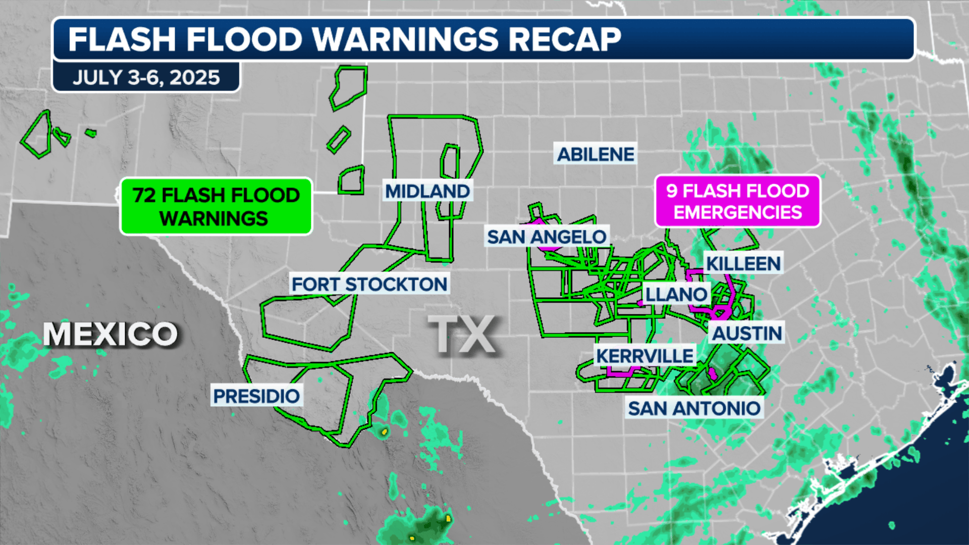
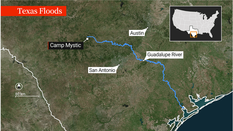
Texas Map Shows Large Parts Of State Under Flood Warnings North Storm Update Flash In Dallas Fort Worth Dallasfort March 2026 Faces Risk Through Friday As Stormy Weather Drags On FOX Maps Show Where Devastating Flooding Hit Including Camp Factors Emergencies Spread To Near Austin Hill Country Reels TX Recap.


Texas Harvey Flood Zone Map FEMA Maps In Houston Explained See Rawimage Disaster Relief Operation Archives Zones Greg Abbott Will Provide All Necessary Resources To Flooding How The Floodwaters Rose Along Guadalupe 2025 Animation Index V4 Threat Continues Central Hill Country 2025.

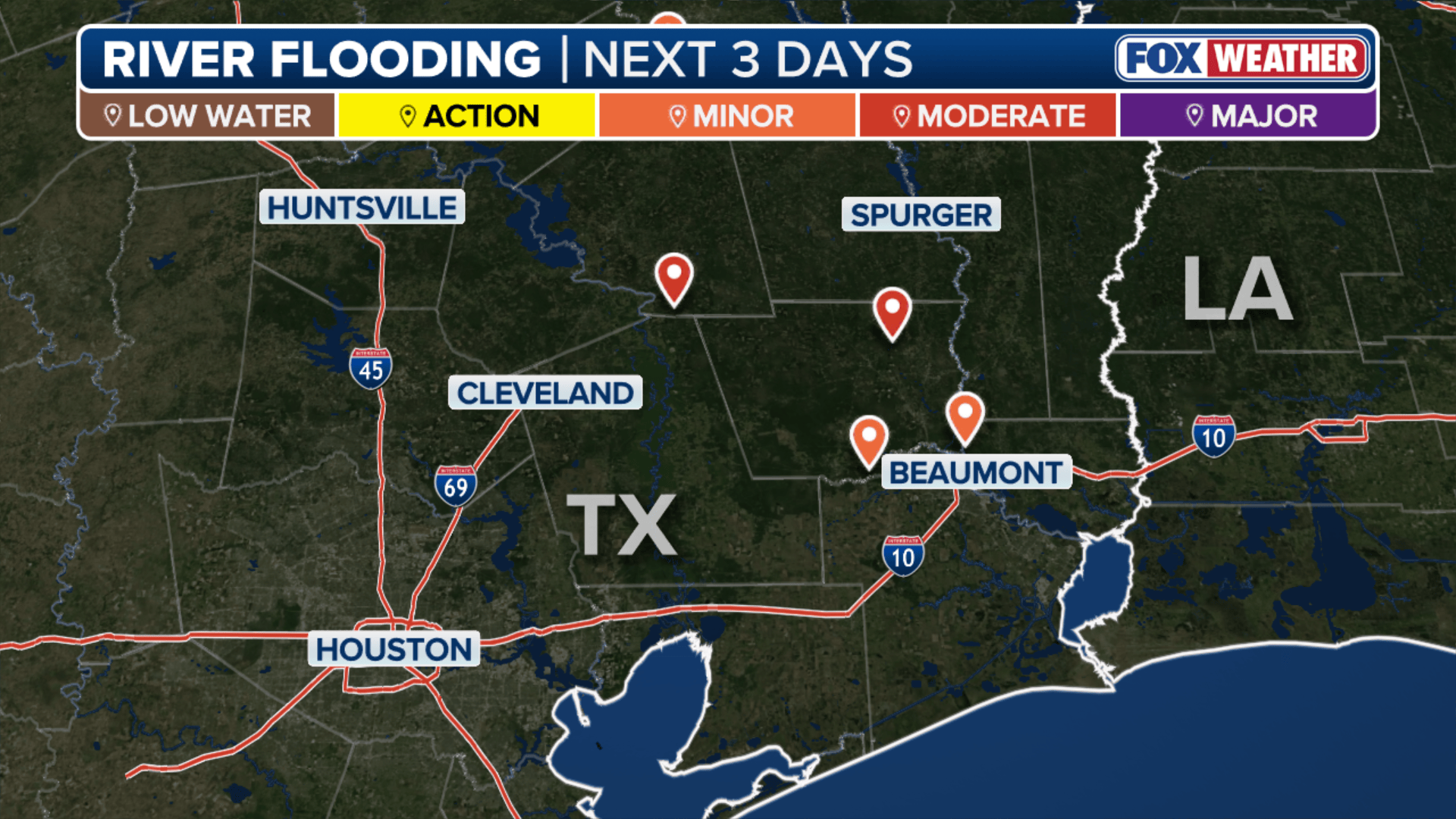
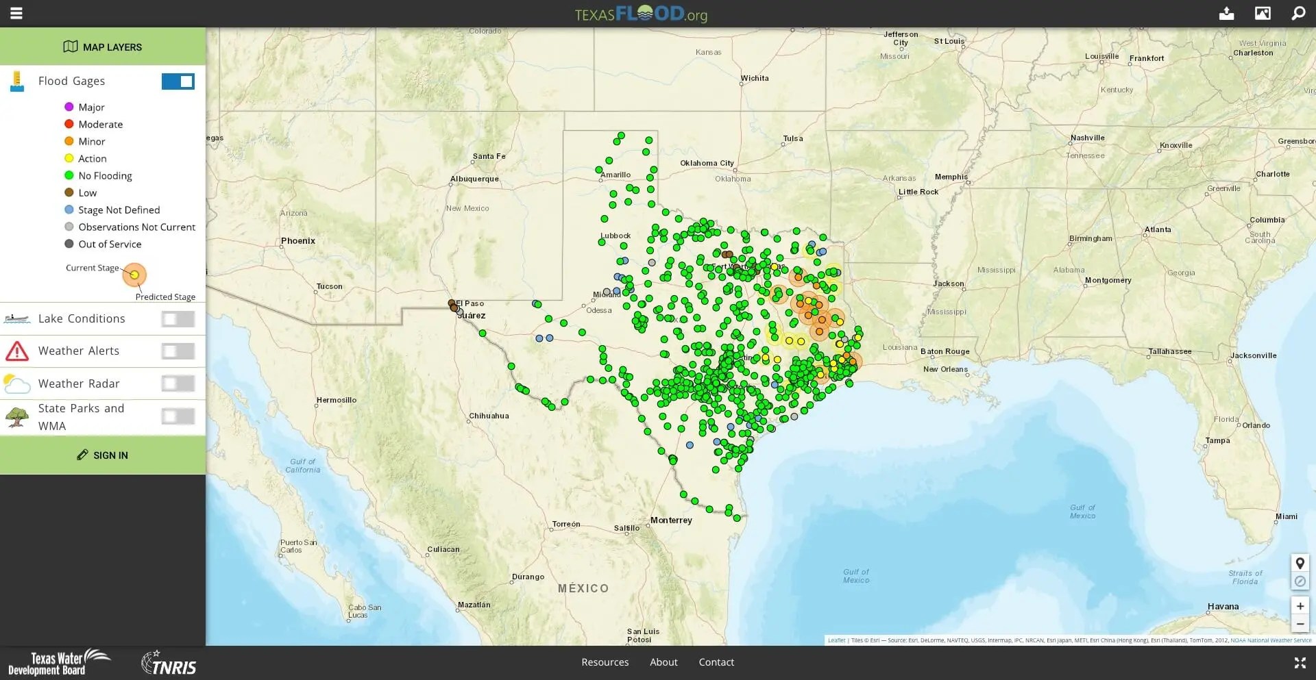
Maps Show Where Devastating Flash Flooding Hit Texas Including Camp Flood Map Ongoing Heavy Rain Bursts Climate Impact Company A Of Different Colors Ai Generated Content Ma Emergencies Spread To Near Austin As Hill Country Reels TX River Stages Forecast In Today Digital Insurance Rate Sat Image Hpembed Fema 2024.


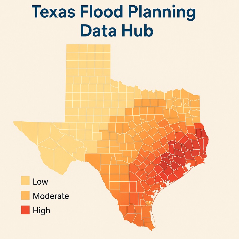
Texas Braces For Dangerous Flooding And More Storms Tonight 20250611 ERODY1 Flood Risk Rising As Heavy Rain Continue Days 20260519 Dead After Bring Record Breaking Floods Officials Say Map IMG 5302 JPG Inundation 2025 Death Toll Causes Guide The Visual.
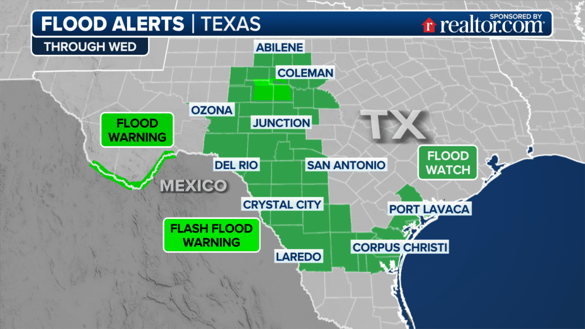

How Did The Texas Floods Get So Bad Fast Everything We Know Map Analyzing Cause Of In Center For Data Innovation Screenshot 2025 At AM Relentless Rains Lead To Swift Water Rescues Swelling Rivers TX Flood Alerts Houston Flooding Parts Southeast High Risk Khou Com E5C0A368 B797 470B 888F Aftermath Desperate Search Survivors As Death Toll.


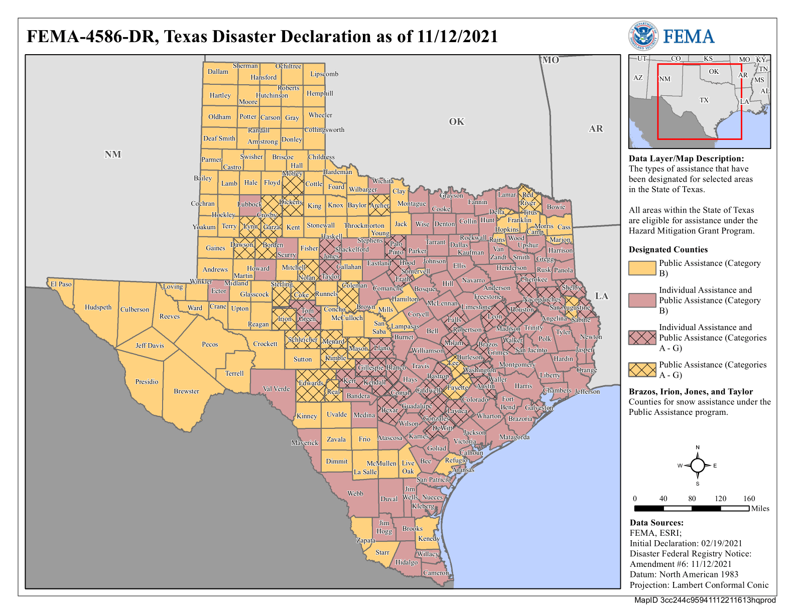
Dallas Texas Flooding Map Flood Insurance Rate City Of Txfloodmon Where Did The Happen In Explora Madeira FAW Remains Eye More Severe Weather Following Deadly Storm Abc Bb 240528 Hpembed Houston 2024 New Fema Maps 2025 Landon SFHA Step Dec 4586.


The Anatomy Of A Flash Flood Why Texas Was So Deadly File 20250711 9tca51 Chilling Maps Reveal Where Devastating Flooding That Killed Over 100090147 14883647 Warnings And Watches Remained In Effect Across Centr Fema 2024 V02 KA Hpembed Timeline Factors Led To Event FDD5D1B6 2bb6 4a95 8232 Continues Central This Morning.